The West Coast Trail
Survivor meets a very long walk in the park

A 56-year-old woman embarks with her partner on the West Coast Trail, a challenging, iconic backcountry backpacking trail on the rugged Vancouver Island in British Columbia, Canada. The route traverse ancient paths and paddling routes used by the first Nations and dishes out physical challenges, from the route itself and difficult weather like driving wind and rain.
When a friend asked if my partner and I would like his extra set of permits for the West Coast Trail, I looked down at the ‘Yes’ tattooed on my forearm and asked, “When do we start?” I didn’t know much about the trail except that it was challenging. Another friend of mine used to do it in 3 days, but he was a madman. Hikers not on destination mode are allowed 14 days to journey through the park. We planned to do it in five and a half.
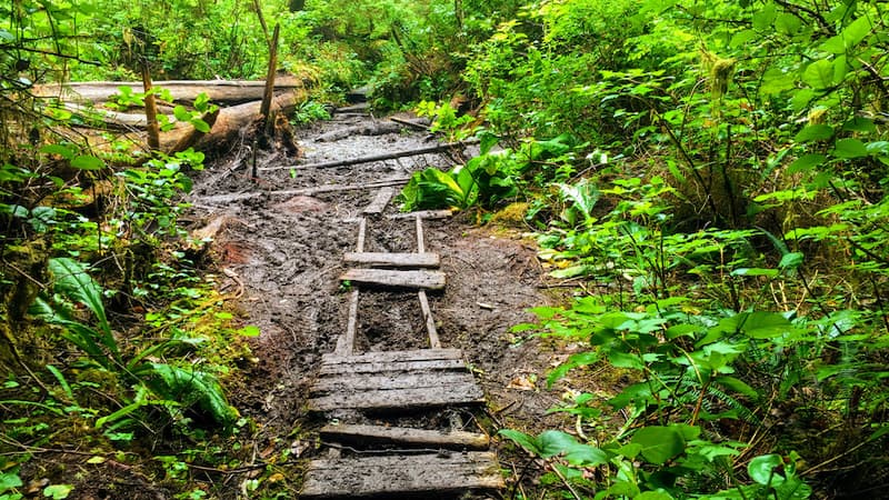
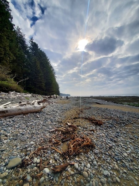
The West Coast Trail is a 75-km trail [about 47 miles] that traverses the beach in some sections and the forest in others. It has 38 ladder structures, numerous log crossings, four cable cars, and two ferry crossings. It requires grit, flexibility, stamina, an understanding of tide charts, a watch, a good backpack with the lightest equipment possible (tent, hiking poles, cooking equipment, etc.), good waterproof hiking boots and gators, and food – plenty of lightweight, filling food.
Since we were transferring permits, the choice of which way to travel the trail was already decided for us. Hikers purchasing permits from the Parks Canada Reservation page have to decide their direction beforehand. Although most travel south to north, our permits started in Pacheena Bay and ended in Gordon River.
There are benefits to both directions of travel and, depending on your personality, one mode may seem better than the other. When you start in Gordon River (S to N), the ferry drops you off on a beach and immediately there is a steep welcome ladder to climb. The first part of the trail is filled with gnarly roots that make foot placement a challenge, but if you make it through the first three days, the rest of the trail is relatively easy. Conversely, when you start in Pacheena Bay (N to S), the first two days with food-laden backpacks are fairly simple hiking, but the most challenges segments are yet to come. By the time the technical hiking starts, the packs are lighter, and the body is more accustomed to the demanding days. The bonus of traveling in this direction is that you tackle the four-hour logging road shuttle taking you from Gordon River to Pacheena Bay trailhead at the beginning. When you finish at Gordon River, it’s an easy jaunt to sign yourself off the trail and head to the parking lot from there.
I am a 56-year-old woman in good physical condition. Six years prior, I walked the Camino de Santiago – a nearly 900-km hike [560 miles] starting in France, trekking through Spain and ending 38 days later at the ocean in Finisterre. On the Camino, I could stop for a second breakfast if I was hungry, and at the end of every day there was a albergue [hostel] waiting for me with a mostly warm shower and a bed. This hike was bound to be different.
Challenges and lessons on the trail
Two months before our start date, we met with our friend, who has done the trail many times, and he started talking about tide charts and details of campgrounds and shuttle buses, but it all sounded like the teacher from Peanuts, “Whah whah whah whah.” I couldn’t retain anything, but perhaps I should have because it wasn’t until the second day on the trail that I realized the importance of those tide charts. On that day, we reached a section of the beach that was passable with tides below 2.7 metres [8.9 feet]. The day was gloomy with persistent fog that hung at the shore, obstructing the view of the headland. The tide was nearing 2.7 metres and my partner’s gut insisted we turn around and go inland. I trusted her gut but was annoyed by our lack of planning and was guilty of giving her my stern eyes. I vowed to plan the next day’s hike in advance.
 My partner and I generally enjoy a go-with-the-flow style, but with the West Coast Trail, that attitude would have us engulfed in the tide. That evening after we set up the tent, I took out our map and surveyed the terrain for the next day’s hike, including the obstacles and tide requirements to make certain beach passes. Our camping neighbour, a first responder by trade, gave us a copy of her hourly tide chart, which made planning much easier. I then used a Sharpie to mark the waterproof map with the times we had to arrive at each portion of the beach. I then worked back to decide what time we had to wake up in the morning to reach the passes at the required tide. For anyone not versed in the behaviour of tides, I recommend printing out an hourly tide chart for the time on the trail.
For me, the trail brought all of my relationships into focus: my relationship with my body, my relationship with my partner, and my relationship with nature. Because my partner had never done a multiday hike, I advised her to pay particular attention to her feet and listen when they were starting to show signs of rubbing. I had managed to walk across Spain without any blisters because of feet vigilance and excellent double-layered hiking socks. What I neglected to listen to was my knee, and four days into the hike, my right knee got cranky from being my lead leg for the whole hike. It was time for my left leg to start doing some work.
When we arrived at the campsite at the end of that day, I exclaimed, “I’m tired of all the choices!” With technical hiking, each spot you choose to place your foot matters. A poorly positioned foot could mean a twisted ankle, a spill, or even worse – an average of 100 hikers are evacuated from the trail each season. It takes focus to make the right choices, and I soon became versed in the variety of seaweed on the rocky surfaces and which colours were more slippery than others.
Then there was the relationship with my partner, aka hiking buddy. It’s a good thing we get along well because this type of challenge could either make or break relationships. In other words, if you don’t get along well with the person you’re in connection with, don’t go with that person. After many turns around the sun, we’ve learned a few things about connection and we managed to breeze through the trail, coming together as a solid team. (My one instance of stern eyes was easily forgiven and we were mindful to keep our sugar levels up so that neither of us became hangry.)
Wildlife on the wild West Coast Trail
As for the sea lions and cougars and bears? They represent nature, the uncontrollable element in the hike. And this is precisely why most hikers choose this backwoods adventure. One man we met at the Crab Shack on our Day 3 said that he loved the hike because he could get away from the constant bombardment of beeps and blips from his cell phone. Although I understood the ubiquitous predicament of modern life, I wondered why he didn’t choose to just turn the ringer off. My first cell phone developed a broken ringer that never alerted me when a call or a text arrived. Although I’ve since replaced that phone many times over, I still maintain the practice of never having the ringer on unless I’m expecting an important call. I don’t want to have to escape my life to get some peace.
My kids made me promise to carry bear mace with me on the hike, but when we went to the outdoors store, they only had large, heavy canisters, so I opted for a smaller horn. Yes, it is possible to see bears on the trail – I saw one but by the time I said, “Look, a bear!” it had scampered back into the woods. The time of year that we were hiking, there were many salal berry patches, a favourite of bears as seen by their scat. Through these areas, we made sure to make plenty of noise to alert any unsuspecting bears. In one of these patches, we passed a scarlet-eyed man who bear-maced his own face when he took off the safety latch before climbing a ladder. When we got to that same ladder nearly an hour after the incident, the burn from cayenne caught in my throat and caused my nose to burn for another hour. The conclusion, you can’t mace a bear without spraying yourself just a bit, and a bit is all it takes to lead to discomfort. https://thenorthwestforager.com/2015/06/29/salal-berry/
A note about the infamous Crab Shack, located around the 32-km mark at the Nitinaht Narrows ferry crossing. This is the only spot where a hiker is able to purchase outside food and drink. Owned and operated by first nation hosts, the Crab Shack started when hungry hikers drooled over the food the owner and his family were eating. Opportunity knocked and now the Crab Shack serves whole or half Dungeness, fresh halibut, lingcod, grilled cheese, and various refreshments. If arriving before 10:45, only breakfast is served, so plan accordingly and bring plenty of cash. (This information is almost as important as the tide charts.)
I’ve been asked several times if I’d do the West Coast Trail again. I wouldn’t, but that is no measure of if it was worthwhile or enjoyable. I would do it again for the first time and I enjoyed almost every moment, but I choose new adventures rather than the repeat of old ones. Maybe that is the wisdom that comes with age … the knowledge that there is more novelty yet to experience.
Fleur Olivier is a writer, artist and nature enthusiast. She aims to live her life with beginner’s eyes and has an ever-expanding list of “Firsts after Fifty.”
Insights on ageism from the Aging Adventurer
Read more insights, experiences, and contributions from Boomer readers in our From the Reader department.
Have your own memories or other stories you would like to share with our baby boomer audience? View our writers’ guidelines and e-mail our editor at Annie@BoomerMagazine.com with the subject line “‘From Our Readers’ inquiry.”


